
Heavy rains flood roads, give way to snow, more rain
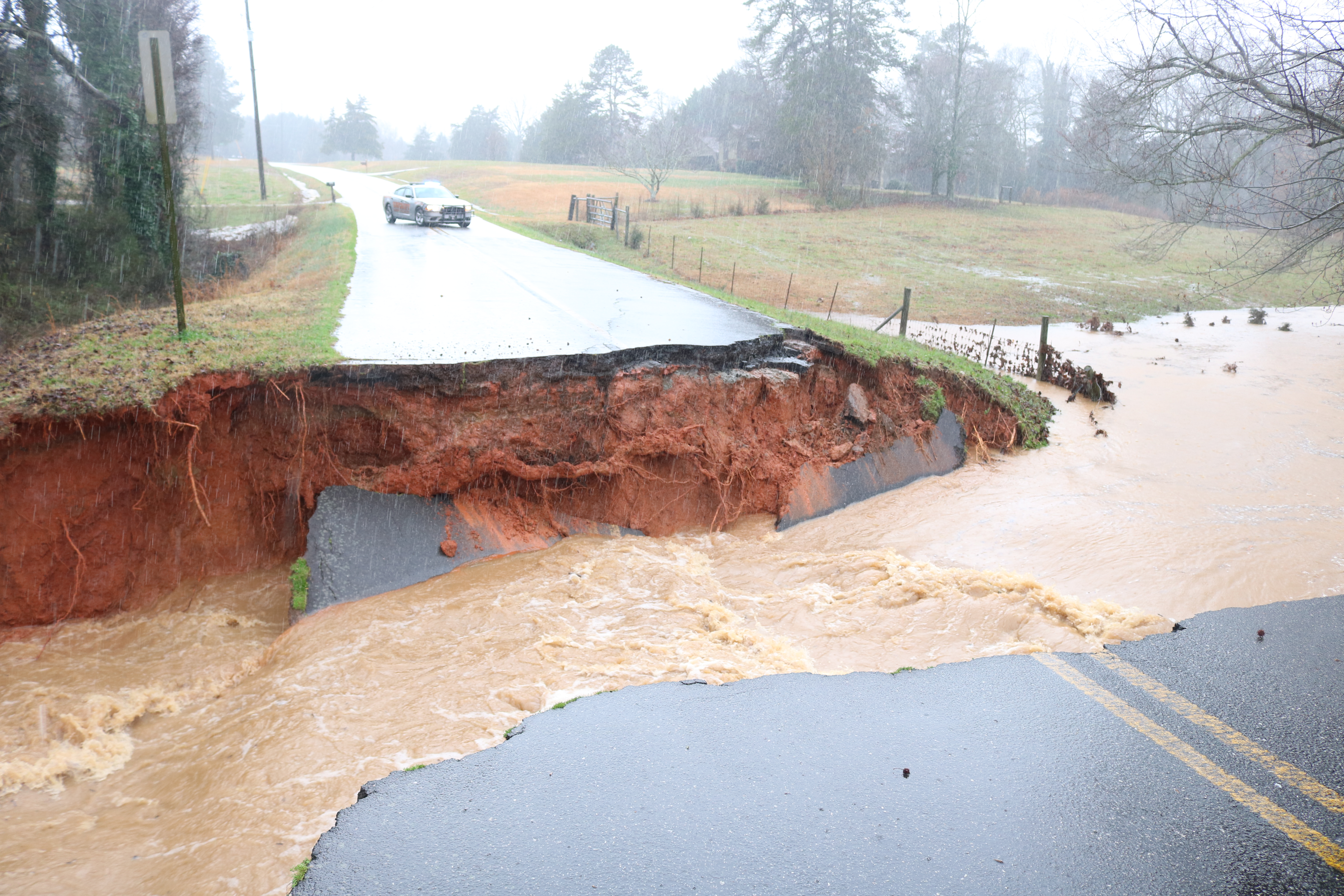
Flood waters washed away roads and damaged homes and cars in Hart County last Thursday, all while a tornado warning threatened the area — but the precipitation isn’t over yet, meteorologists say.
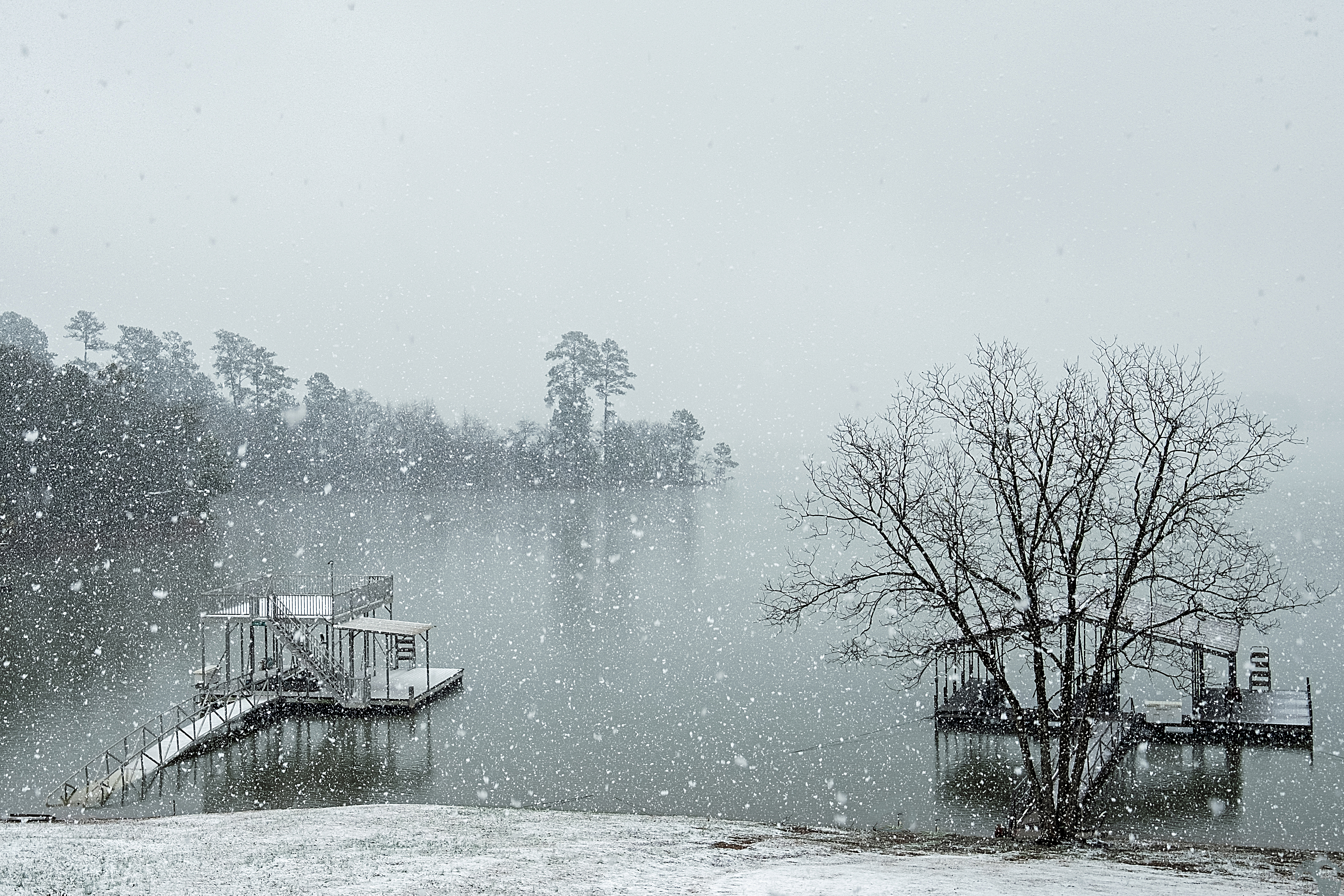
The barrage of rain and flash flooding on Feb. 6 turned to snow on Feb. 8 as temperatures dropped and settled in the area Saturday. About 1.5 inches of snowfall fell in Hart County, National Weather Service Meteorologist Doug Outlaw told The Hartwell Sun. Some areas towards the mountains saw as much as eight inches of snow.
Another flash flood warning was issued in the county on Tuesday. Outlaw says it will continue to be wet throughout the week, with rain and possible storms rolling in Thursday. Though, dry weather is expected Friday and Saturday.
Total rainfall for the month of February in Hartwell is already at 7.58 inches, Outlaw said. From the morning of Feb. 5 to the morning of Feb. 6, a total of 1.8 inches fell, followed by 3.61 inches of rain between the morning of Feb. 6 and Feb. 7, the 24-hour period that saw the most drastic flooding in Hart County.
Numerous roads in the county washed away or were impassable due to flooding. At least 36 roads were closed temporarily, and of those, five roads could be closed long-term. County Administrator Terrell Partain said last week the following roads would be closed long-term due to damage: Deer Run Lane; Wisteria Cove Estate; Alexander Ray Road; Hill Road and Jud Cole Road.
A tornado never touched down in Hart County, or Northeast Georgia, despite the warning, Outlaw said. However, there were six reported tornadoes ranging from Spartanburg, S.C., to Charlotte, N.C.
The rain pushed Lake Hartwell into flood storage stage and well above full summer pool, U.S. Army Corps of Engineers spokesperson Billy Birdwell said on Tuesday. The corps does not expect to open the spillways on Lake Hartwell or any of the reservoirs this week, Birdwell said.
The two reservoirs that Lake Hartwell feeds are also in flood stage, Lake Russell and Lake Thurmond, also known as Clarks Hill Lake. Lake Hartwell’s water level was 663.44 as of Tuesday morning, easily surpassing 657.8, where it was supposed to be on Tuesday, Birdwell said.
“So we are above our ideal for the day,” Birdwell said. “But that’s OK. We have the space. We can store the water there and release it as we can.”
Birdwell said the water is running through the turbines “pretty hard” currently. The corps typically runs water through the turbines for a few hours each day depending on the season and conditions, but it is currently operating almost all of the time.
“So that pushes water downstream pretty turbulently,” Birdwell said. “And that pushes it into (Lake) Russell. Then with Russell already being in flood stage it has to run pretty hard and then it dumps into (Lake) Thurmond. Well, Thurmond is in flood stage so it’s running hard and so it has to push it downstream, but we have to be careful doing that or we will contribute to local flooding in the Augusta area.”
The corps will continue to monitor the water levels carefully, Birdwell said.
While temperatures rose into the 70s on Tuesday, following the weekend snow, the warmth did not last. The weather service is predicting sunny days on Friday and Saturday but with highs in the 40s.